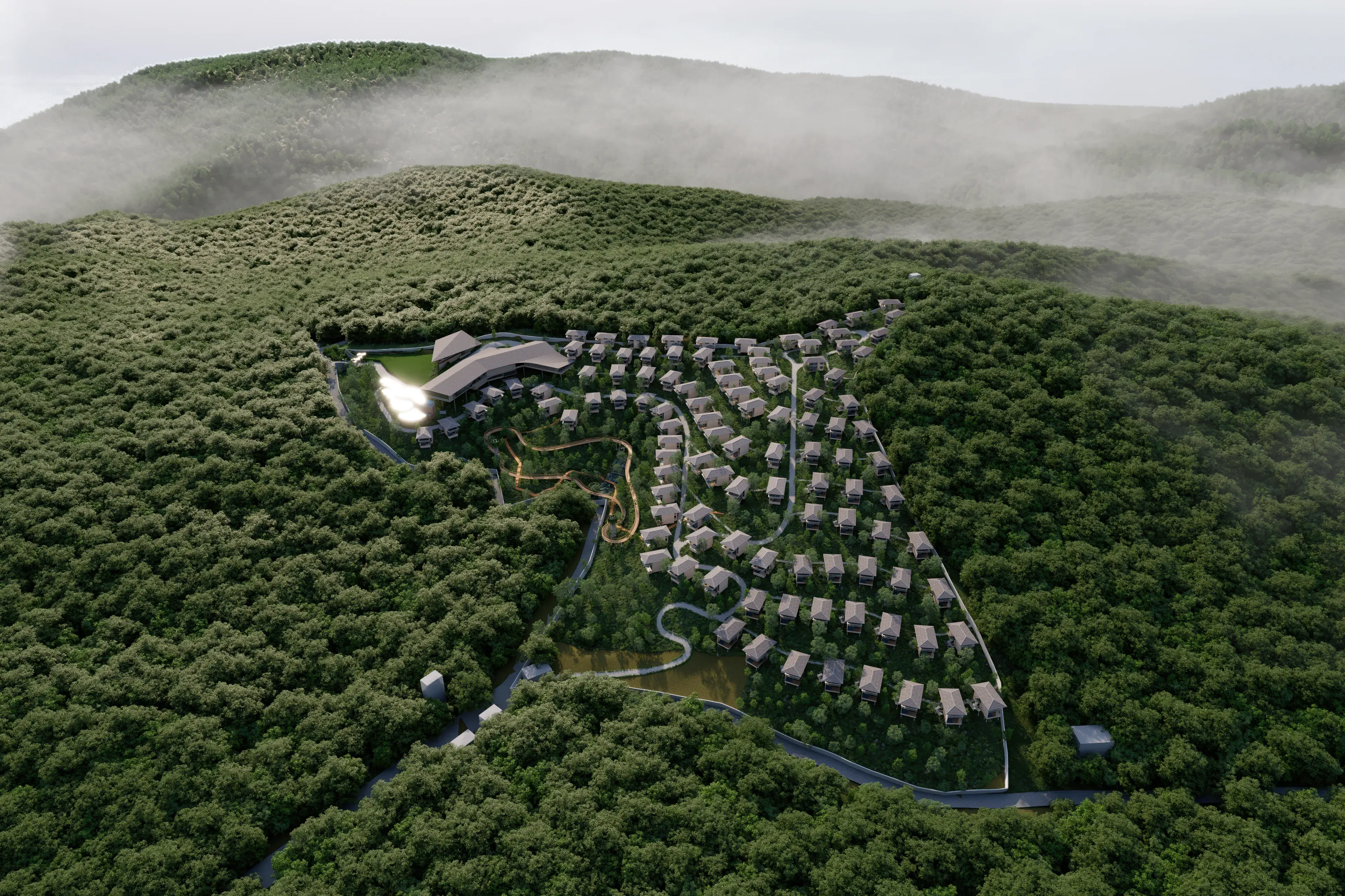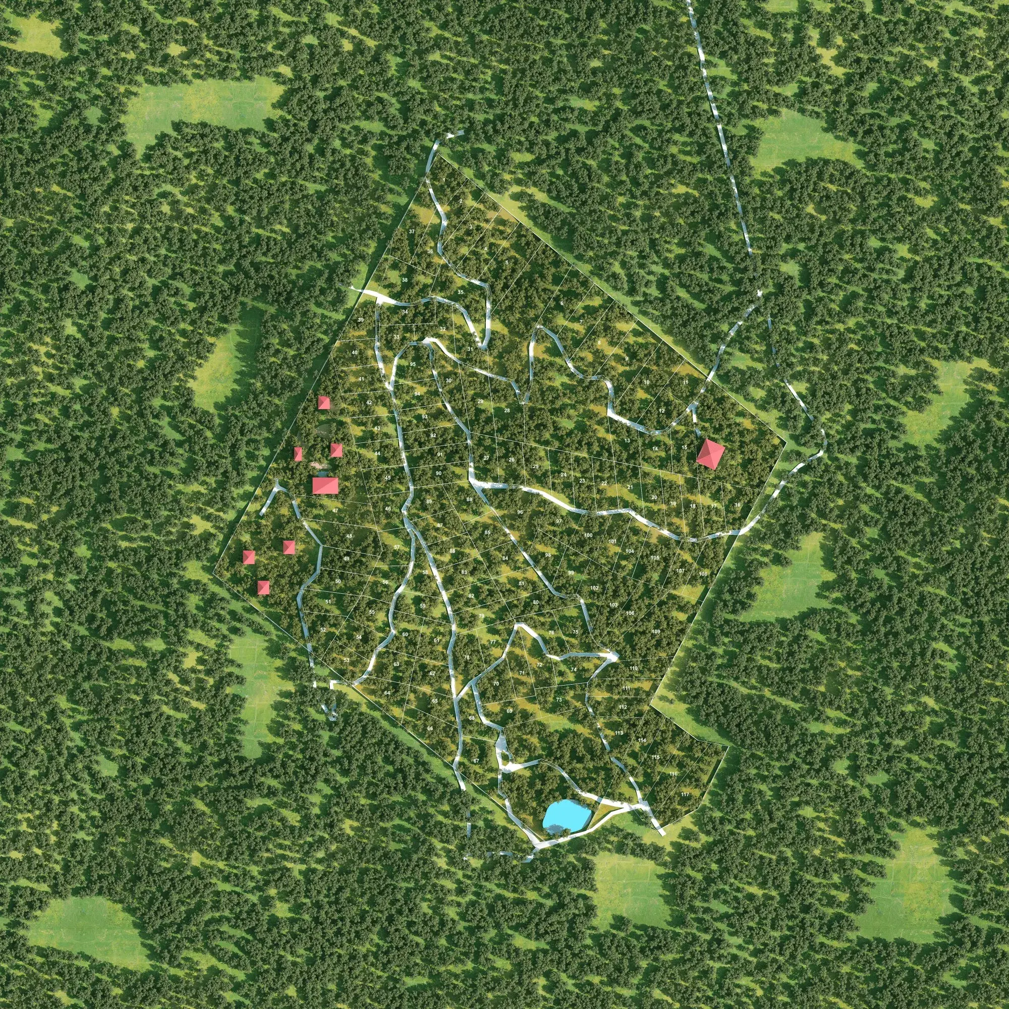
The real estate industry is rapidly moving toward interactive and data-driven sales experiences. Traditional master plans, printed brochures, static layout images, and spreadsheets can make it difficult for buyers and sales teams to understand plot availability, location, dimensions, pricing, amenities, and surrounding infrastructure.
Interactive Plot Mapping Software solves this challenge by transforming a traditional property layout into a dynamic digital experience where users can explore plots, check availability, access property information, navigate nearby locations, and submit enquiries directly from an interactive map.
At Luminexa Technologies, we develop intelligent real estate plot mapping solutions designed for plotted developments, villa communities, farmland projects, gated communities, and large-scale property developments.
What is interactive plot mapping?
Interactive plot mapping is a digital representation of a real estate development where individual plots or properties become clickable and data-driven. Instead of viewing only a static master plan, buyers can interact with the project layout and select individual plots to access relevant information.
Depending on the project, an interactive plot map can display:
- Plot number, dimensions and area
- Facing and orientation
- Plot status — available, blocked, booked or sold
- Pricing information and property specifications
- Amenities, roads and internal connectivity
- Nearby landmarks
- Site images, videos and 360° virtual tours
- Location and navigation information
- Enquiry and site-visit options
This creates a more engaging property discovery experience while giving sales teams a centralized platform for presenting project information.
Why real estate developers need interactive plot mapping
Property buyers increasingly research projects digitally before contacting a sales representative or visiting the site. A static layout may show the overall development, but it cannot easily answer questions such as:
- Which plots are currently available?
- What is the size and facing of Plot 52?
- How far is the clubhouse from this plot?
- Which plots are close to the entrance?
- What amenities are available nearby?
- How is the project connected to major roads and landmarks?
An interactive real estate map brings this information together within a single visual interface.
Make property selection easier
Buyers can visually explore the entire development and select individual plots instead of searching through spreadsheets, PDFs, or printed master plans. This makes it easier to compare multiple properties based on location, dimensions, facing, amenities, and other project-specific information.
Display real-time plot availability
Interactive plot mapping can be connected with a backend inventory management system, with plot statuses displayed as available, blocked, reserved, booked or sold. When the sales or administrative team updates inventory from the backend, the latest information is reflected on the customer-facing map — which reduces confusion between marketing, sales, and inventory teams.
Interactive plot mapping and inventory management
One of the biggest advantages of a digital plot mapping platform is its ability to connect the visual master plan with actual property inventory. Instead of maintaining the layout and inventory as completely separate systems, developers can manage property information through a centralized dashboard.
When a plot is booked, its status is updated from the admin panel and reflected on the interactive map. This creates a connected workflow:
Project layout → Plot data → Inventory → Sales team → Customer
The result is a more efficient and transparent property sales process.
Integrating GIS and location intelligence
Modern GIS mapping for real estate can provide much more than a project boundary. Location intelligence helps customers understand the project's connectivity and surrounding infrastructure, highlighting nearby highways and major roads, schools, hospitals, airports, railway and metro stations, shopping centres, IT parks, tourist destinations, commercial hubs and other important landmarks.
Route integration can also help users understand approximate distance, travel direction, and connectivity between the development and important locations. This is especially valuable for plotted developments and farmland projects located outside major urban areas.
Interactive master plans for real estate projects
A traditional master plan contains valuable project information, but customers may find complex layouts difficult to understand. An interactive master plan converts the project layout into a digital interface where users can zoom, pan, select plots, explore amenities, and access individual property information without navigating through multiple documents.
For developers, this provides a modern way to showcase the complete project through websites, sales presentations, experience centres, and digital marketing campaigns.
Combine plot mapping with 360° virtual tours
Interactive plot mapping becomes even more powerful when combined with 360° virtual tours. Customers can first understand the overall project through the interactive map, then explore selected locations through immersive panoramic views — the project entrance, internal roads, clubhouse, amenities, landscaped areas, model villas, plot surroundings and aerial viewpoints.
This gives potential buyers a stronger understanding of the property before an actual site visit.
3D interactive mapping and digital twin experiences
For premium developments, traditional 2D mapping can be extended into 3D interactive property visualization. A 3D experience helps users understand buildings, villas, terrain, roads, landscapes, amenities, and the overall development from different perspectives.
Interactive 3D experiences can also integrate property information, inventory status, virtual tours, floor information, and project navigation — creating a digital representation of the development that can be used by both customers and sales teams.
Benefits of interactive plot mapping for developers
- Better customer experience. Customers get a visual, interactive way to understand the development rather than relying only on brochures and static plans.
- Faster property discovery. Buyers can quickly shortlist plots by location, size, facing and availability.
- Centralized property information. Plot information, availability and specifications are managed through one system.
- Improved sales presentations. Sales teams can demonstrate the entire development on laptops, tablets, large displays or customer-facing websites.
- Better digital marketing. Advertising traffic lands on an interactive property exploration experience rather than a basic landing page.
- Less dependency on static documents. Property information is updated digitally instead of redistributing revised PDFs or printed layouts.
Who can use interactive plot mapping?
Interactive mapping technology can be customized for residential plotted developments, villa projects, gated communities, farmland and managed farmland developments, township projects, commercial developments, resort developments, large land parcels and mixed-use developments.
The platform is adapted according to the project's layout, sales process, inventory structure, and customer experience requirements.
Interactive plot mapping for farmland projects
Farmland projects often cover large geographical areas where understanding individual plots through a conventional layout can be challenging. An interactive farmland map helps customers visualize plot boundaries, internal roads, plantations, amenities, terrain, nearby landmarks and project connectivity.
Additional information such as plot area, plantation type, availability, pricing and property details can also be connected to individual plots, which makes interactive mapping particularly useful for managed farmland and agricultural investment projects.
Turn your real estate website into an interactive sales platform
A modern real estate website should do more than display project images and contact information. By integrating interactive plot mapping, real-time inventory, 360° virtual tours, GIS mapping, CRM, automation and immersive 3D visualization, a website becomes a complete digital property discovery and sales platform.
Potential buyers can explore the project, understand available properties, review important information, and submit an enquiry or schedule a site visit from the same experience.
Build your interactive plot mapping solution with Luminexa
Luminexa Technologies develops customized digital solutions that help real estate businesses present, manage and sell properties through interactive technology. Our solutions can combine:
- Interactive plot mapping and interactive master plans
- GIS and location mapping
- Real-time property inventory
- 360° virtual tours and 3D immersive experiences
- Digital twin solutions
- CRM integration, lead management and site-visit booking
- Sales automation and AI-powered property assistance
- Custom web applications
Every development is different, so the mapping experience is customized according to the project's master plan, inventory structure, branding, sales workflow and business requirements.
Looking for interactive plot mapping software for your project?
Transform your static property layout into an intelligent and interactive digital sales experience. Connect with Luminexa Technologies to schedule a demonstration of our interactive plot mapping and immersive real estate technology solutions.
Frequently asked questions
What is interactive plot mapping software?+−
Interactive plot mapping software converts a real estate master plan or layout into a digital interactive map where customers can select individual plots and view information such as plot number, dimensions, area, facing, availability, pricing, and other property details.
Can plot availability be updated in real time?+−
Yes. The interactive map can be connected with a backend inventory management system so authorized teams can update property statuses such as available, blocked, booked, reserved, or sold.
Can interactive plot mapping be integrated into an existing website?+−
Yes. Depending on the website and technical requirements, an interactive mapping application can be integrated into an existing real estate website or deployed as a dedicated web application.
Can 360° virtual tours be added to the plot map?+−
Yes. 360° panoramas, drone views, images, videos, and other visual experiences can be connected to relevant locations within an interactive project map.
Is plot mapping suitable for farmland projects?+−
Yes. Interactive mapping is particularly useful for farmland and plotted developments because it helps customers understand large project layouts, individual plot boundaries, roads, amenities, plantations, surrounding areas, and availability.
Can CRM and lead management be integrated?+−
Yes. Interactive mapping can be connected with enquiry forms, site-visit booking, CRM systems, lead management workflows, and other sales automation tools.